- Search
Find available space, buildings, contacts - Map Search
Define your own search area and build custom analytics
- Perspective
Market analytics and statistical reporting - My InSite
My Listings, My Surveys, My Profile
Maps and Boundaries
NEW! Map Search and Analytics Feature
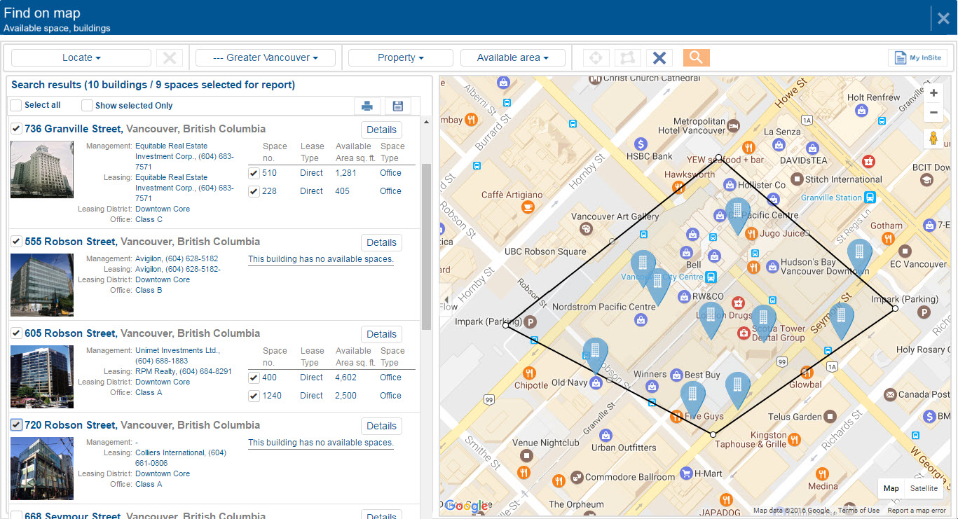
The new map-driven search tool brings more flexibility to your space searches and an improved ability to find market and building statistics. Use radius and polygon tools to define custom search regions and quickly analyse current and historical vacancies, absorption trends, and space availabilities. To view the user guide, please click here.
Static, 2D District maps with node boundaries
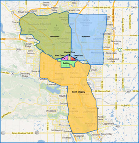
View full-colour, staticstatistical geography maps showing each of our six major office markets in Canada, as well as maps for each of the districts, and the nodes within each district, for those markets. Maps are also available for our statistical boundaries for our Toronto Industrial market and district boundaries. More markets to follow.
To access the new maps, please follow the Office or Industrial link from the navigation menu below and select the market of your choice.